Wildfires
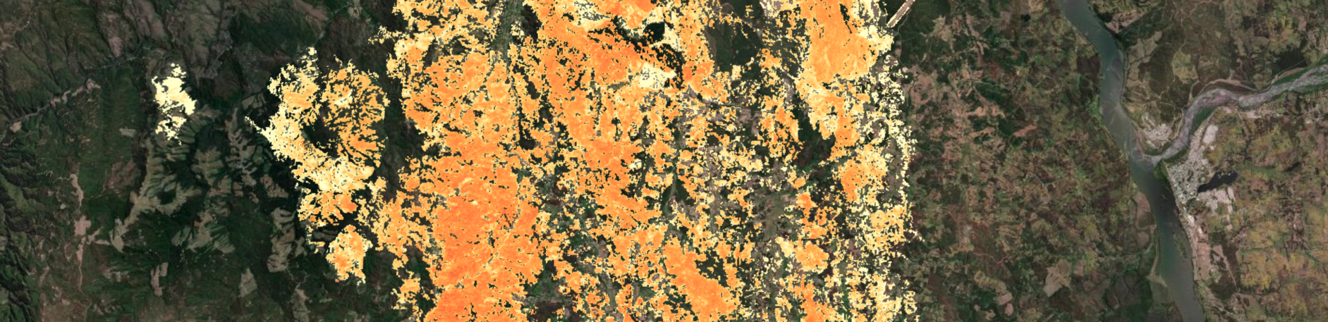
For the Wildfire theme, the CopernicusLAC Platform offers a suite of Earth Observation services to support wildfire risk management through the detection, monitoring, and analysis of active fires, fire danger and post-disaster recovery. Leveraging high-resolution data from the Copernicus Sentinel satellites, these services address all phases of wildfires hazard, providing both basic and end-to-end solutions to assess the pre-, post- and ongoing, NRT wildfires disaster.
Wildfire services
Burned Area Mapping
The Burned Area Mapping (BAM) service exploits Sentinel-3, Sentinel-2 and VIIRS data to monitor areas affected by wildfires with the detection of active fires through hotspot identification from TIR bands, and with the mapping of burned area extent and severity from NIR and SWIR bands.
Access the BAM service information:
Fire Danger Mapping
The Fire Danger Mapping (FDM) service provides a qualitative fire danger index per pixel analysed through the combination of environmental variables that are key contributors for fire ignition and propagation.
Access the FDM service information:
Fire Recovery Mapping
The Fire Recovery Mapping (FRM) service allows to monitor the spectral post-fire recovery through multitemporal NDVI composites analysis derived from Sentinel-2 imagery.
Access the FRM service information:
Burned Area Severity
The Burned Area Severity (BAS) service estimates with optical imagery the severity of burn areas using the Normalized Burn Ratio (NBR) and its derivatives.
Access the BAS service information:
Coherence and Intensity Composite
The Coherence and Intensity Composite (SAR-COIN) service exploits Sentinel-1 SLC data to compute coherence and backscatter from image pairs and produce band composites to highlight significant changes in the surface.
Access the SAR-COIN service information:
SAR-COIN service specifications
Filter and Vectorize Discrete Raster
The Filter and Vectorize Discrete Raster (FilterVectorize) service allows to spatially filter and vectorize a discrete raster. Outputs are a single filtered raster and the converted polygon vector.
Access the FilterVectorize service information:
FilterVectorize service specifications
NDVI Change Detection
The NDVI Change Detection (NDVI-CD) service allows to process pairs of optical images to provide a change detection mask through the difference of NDVI composites. The output is a binary map representing the NDVI loss, in raster and vector formats.
Access the NDVI-CD service information:
NDVI-CD service specifications
Co-located Stacking
The Co-located Stacking (STACK) service allows to co-locate, resample and warp multi-mission and multi-temporal rasters with respect to a reference.
Access the STACK service information:
Dedicated platform
The CopernicusLAC platform offers a thematic web application, the Wildfire Results Explorer, designed to visualize and analyze service outputs generated by the 3 wildfire services.
Click on the below button to get an overview about the Wildfire Results Explorer of the CopernicusLAC platform.
Click on the below button to find a description of all the layers available in the Wildfire Results Explorer of the CopernicusLAC platform.
Layers of the Wildfire Results Explorer
Click on the button below to download the slides from the final demonstration of the wildfire pilot services developed for the CopernicusLAC platform.
CopernicusLAC Wildfire Pilot Services - Demonstration of Pre-Operational Phase - 11 February 2025
Copernicus Context
In addition to the Sentinel missions, the Copernicus program provides a comprehensive set of services to support wildfire risk management across all phases —from early warning and preparedness to real-time monitoring and post-event analysis.
These services are delivered through the Copernicus Emergency Management Service (CEMS), the European Forest Fire Information System (EFFIS), and the Global Wildfire Information System (GWIS).
Copernicus Emergency Management Service (CEMS)
The Copernicus Emergency Management Service (CEMS) provides geospatial information to support wildfire disaster management through:
- Rapid Mapping: Near-real-time mapping of active fires and burned areas.
- Risk and Recovery Mapping (RRM): Detailed assessments of fire impact, land cover change, and post-fire recovery.
- Early Warning and Monitoring: Integration of fire danger indices and satellite observations to support preparedness and response.
Details concerning the CEMS are provided in the Annex.
European Forest Fire Information System (EFFIS)
The European Forest Fire Information System (EFFIS) supports wildfire prevention and response in Europe and neighboring regions by offering:
- Real-time fire monitoring and hotspot detection.
- Daily and seasonal fire danger forecasts.
- Historical fire data and damage assessments.
Global Wildfire Information System (GWIS)
The Global Wildfire Information System (GWIS) extends the capabilities of EFFIS to a global scale, providing:
- Global fire danger forecasts and risk indicators.
- Burned area mapping and fire emissions estimates.
- Tools for international cooperation and data sharing.