Concepts
The CopernicusLAC Platform provides access to EO data coming from several missions and sensors and provided using different data formats and metadata.
These acquisitions have heterogeneous formats for the data files and associated metadata.
To reduce this heterogeneity, the CopernicusLAC Platform seeks to pre-process the acquisitions into a common format which, on the one hand, provides a ready-to-inspect and comparable dataset and, on the other, to have downstream processing services that support multi-sensor and multi-mission acquisitions without implementing complex blocks.
Below are described the main pre-processing that support this approach.
STAC as a common metadata model
EO data is handled under the CopernicusLAC Platform processing chains using the SpatioTemporal Asset Catalog (STAC)1.
STAC consists of a standardized way to catalog and expose multi-source geospatial data. The basic core of STAC1 is adopted and extended within the CopernicusLAC Platform to manage a wide collection of multi-source satellite imagery using multiple STAC “spatiotemporal” Assets.
Each STAC item (e.g. a single Sentinel-2 MSI L2A product over tile T18PWS and track 25) includes multiple assets (e.g. multiple multispectral bands) and consists of a GeoJSON feature with metadata and thumbnail and can be organized under a STAC Catalog (e.g. multitple Sentinel-2 MSI L2A products acquired over multiple tiles, tracks and sensed in different time).
Each STAC Catalog can be then grouped under a STAC Collection (e.g. Sentinel-2 L1C) which can also further complement associated metadata information such as producer, processor, host, license, version, temporal extent, GSD, instrument, off-nadir angle, etc. More information can be found at STAC Common Metadata section of STAC Specification documentation2.
Common Band Names (CBN)
STAC assets of EO data are catalogued in the CopernicusLAC Platform using Common Band Names (CBN)2. CBN classes refer to common band ranges derived from pre-defined frequency ranges of the Electromagnetic Spectrum made for several popular instruments. Each CBN class is defined by a Band Range in micrometers for optical and in centimeters for SAR data. The CBN classification of the frequency spectrum allows a one-to-one mapping of multi-mission and multi-sensor bands (Optical and SAR). CBN thus eases the handling of multi-sensor source EO data.
Optical Common Band Names
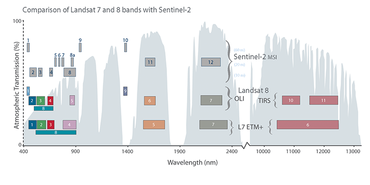
To classify a generic band from an optical sensor with the CBN schema (e.g. Worldview-3 Yellow band from 0.584 to 0.632 μm), one way is to derive its centered wavelength in micrometers (0.608 μm) and identify the CBN class having the closest central wavelength (CBN class 05 and centered at 0.6 μm). However, while choosing a CBN class also the bandwidth needs to be considered. Common Band Names "nir" and "lwir" refer, in fact, to wider bands that cover most of the spectral range for NIR (0.75μm to 1.0μm) and TIR (10.5μm to 12.5μm) radiation. On the other hand, narrow bands for "nir" are "nir08" and "nir09", centered at 0.85μm and 0.95μm respectively. This is particularly useful for example to classify sensors having both a wide (e.g. Sentinel-2 MSI Band 8 at 833 nm) and a narrow (Sentinel-2 MSI Band 8a at 865 nm) band over the same portion of the EM spectrum. CBN "nir" will refer then to S2 MSI spectral Band 8 and "nir08" to the S2 MSI spectral band 8a.
The same applies for "lwir" which is also discretized into two narrow bands "lwir11" and "lwir12", centered at 11μm and 12μm respectively. The CBN schema is not rigid and allows the definition of new classes in case the definition of an additional portion of the spectrum is required (e.g. to deal with future EO missions in the CopernicusLAC Platform Optical Payload having different spectral resolution that cannot be fully classified with the current CBN schema).
A total of 31 CBNs (pan, coastal, blue, yellow, etc.) are identified for the CopernicusLAC Platform (see Table 1). This table also includes a sample application of this CBN schema, made for Sentinel-3 SLSTR, Landsat-8 OLI/TIRS and Sentinel-2 MSI data.
| CBN code | Common Band Name (CBN) | Band Range (μm) | Sentinel 3 SLSTR+ | Landsat 8 OLI / TIRS | Sentinel-2 MSI |
|---|---|---|---|---|---|
| CBN-01 | pan | 0.50 - 0.70 | 8 | ||
| CBN-02 | coastal | 0.40 - 0.45 | 1 | 1 | |
| CBN-03 | blue | 0.45 - 0.50 | 2 | 2 | |
| CBN-04 | green | 0.50 - 0.60 | S1 | 3 | 3 |
| CBN-05 | yellow | 0.58 - 0.62 | |||
| CBN-06 | red | 0.60 - 0.70 | S2 | 4 | 4 |
| CBN-07 | rededge | 0.70 - 0.79 | |||
| CBN-08 | rededge70 | 0.69 - 0.71 | 5 | ||
| CBN-09 | rededge74 | 0.73 - 0.75 | 6 | ||
| CBN-10 | rededge78 | 0.69 - 0.71 | 7 | ||
| CBN-11 | nir | 0.75 - 1.00 | S3 | 5 | 8 |
| CBN-12 | nir08 | 0.75 - 0.90 | 8a | ||
| CBN-13 | nir09 | 0.85 - 1.05 | 9 | ||
| CBN-14 | swir12 | 1.19 - 1.21 | |||
| CBN-15 | cirrus | 1.35 - 1.40 | S4 | 9 | 10 |
| CBN-16 | swir16 | 1.55 - 1.75 | S5 | 6 | 11 |
| CBN-17 | swir155 | 1.45 - 1.65 | |||
| CBN-18 | swir165 | 1.65 - 1.75 | |||
| CBN-19 | swir173 | 1.72 - 1.74 | |||
| CBN-20 | swir22 | 2.10 - 2.30 | S6 | 7 | 12 |
| CBN-21 | swir215 | 2.13 - 2.17 | |||
| CBN-22 | swir220 | 2.18 - 2.22 | |||
| CBN-23 | swir225 | 2.23 - 2.27 | |||
| CBN-24 | swir23 | 2.28 - 2.32 | |||
| CBN-25 | mwir38 | 3.5 - 4.1 | S7 | ||
| CBN-26 | lwir | 10.5 - 12.5 | |||
| CBN-27 | lwir09 | 8.5 - 9.5 | |||
| CBN-28 | lwir11 | 10.5 - 11.5 | S8 | 10 | |
| CBN-29 | fire1 | 10.5 - 11.5 | F1 | ||
| CBN-30 | lwir12 | 11.5 - 12.5 | S9 | 11 | |
| CBN-31 | fire2 | 11.5 - 12.5 | F2 |
To better explain the advantages in managing multi-sensor EO optical data with CBN, an application of CBN schema, made for a selection of the CopernicusLAC Platform optical payload is shown in Table 2. This enables a clear mapping of EO data across the EM spectrum with STAC assets.
| Satellite | Sensor | CBN-01 | CBN-02 | CBN-03 | CBN-04 | CBN-05 | CBN-06 | CBN-07 | CBN-08 | CBN-09 | CBN-10 | CBN-11 | CBN-12 | CBN-13 | CBN-14 | CBN-15 | CBN-16 | CBN-17 | CBN-18 | CBN-19 | CBN-20 | CBN-21 | CBN-22 | CBN-23 | CBN-24 | CBN-25 | CBN-26 | CBN-27 | CBN-28 | CBN-29 | CBN-30 | CBN-31 |
|---|---|---|---|---|---|---|---|---|---|---|---|---|---|---|---|---|---|---|---|---|---|---|---|---|---|---|---|---|---|---|---|---|
| Landsat-8 | OLI/TIRS | P | C | B | G | R | X | X | X | X | X | X | ||||||||||||||||||||
| Landsat-9 | OLI/TIRS | P | C | B | G | R | X | X | X | X | X | X | ||||||||||||||||||||
| Sentinel-2 | MSI | C | B | G | R | X | X | X | X | X | X | X | X | X | ||||||||||||||||||
| Sentinel-3 | SLSTR | G | R | X | X | X | X | X | X | X | X |
Different types of output products
In the CopernicusLAC Platform two main types of Product can be derived from both systematic and on-demand processing services:
-
overview assets (full-res browse images as grayscale or RGB composite).
-
single band assets (TOA reflectance, Brightness Temperature, spectral indexes, change detection bitmasks, etc.).
Each of them is given by following a dedicated data structure (e.g. unit, data type, scale factor, valid range) with respect to the nature of the product. More details about each of the physical meaning or visual products of the CopernicusLAC Platform can be found in the specifications of each service.
A common format for output raster products
All the output raster products derived from the CopernicusLAC Platform processing services are given in the Cloud Optimized GeoTIFF (COG)3 format. COG is an extension of the GeoTIFF format dedicated for data hosting on HTTP file servers. One of the main advantages in using COG format in cloud processing environments is that the single GeoTIFF file can be accessed by multiple clients with no need to copy or cache the desired product.
Furthermore, it allows the client to easily retrieve via HTTP GET range requests just a desired portion of the data required for more efficient workflows on the cloud. As an example, in the CopernicusLAC Platform the pre-processed datasets are stored in COG format to reduce data transfer during thematic processing. The COG format is already employed under multiple initiatives such as: OpenAerialMap, INPE, MAXAR/DigitalGlobe, Planet, NASA and Copernicus’s Mundi DIAS. STAC and COG have been recently adopted by USGS for the provision of Landsat-7 and Landsat-8 products, as described in the USGS Data Format Control Book4 which describes the format of the data to be used in Collection 2 processing.
-
SpatioTemporal Asset Catalog Core Specification, The core components of STAC, https://stacspec.org/core.html. ↩↩
-
Radiant Earth Foundation, STAC specification, GitHub Readme. ↩↩
-
Cloud Optimized GeoTIFF, An imagery format for cloud-native geospatial processing, [https://www.cogeo.org]](https://www.cogeo.org/){:target="_blank"}. ↩
-
Landsat Cloud Optimized GeoTIFF Data Format Control Book, The core components of STAC, available at. ↩